For the past two weeks, we have been studying maps. As an introduction to maps, we read the story, Me On The Map.

This story is great because it gives the students an idea of their own place in space.
The little girl in the story starts in her own place, her bedroom and then draws maps all the way out to her planet, Earth. The illustrations are wonderful because they first show a map and then show a child drawn map to show how the girl drew her own map.
After reading the story, we made our very own maps using a great template I found online. We started with our houses. I demonstrated how to make a map of your house and then the children made their own maps of what their houses looked like, labeling important places like the kitchen, bedrooms, and bathrooms.


Next, we moved out a little farther and the students learned about their streets. Their weekend homwork was to find out their address and then they had to draw their street, including their house and a few neighbor's houses.


After we all made our own streets, we started to talk about our city. We looked at some google maps of our town and found important places like our school and other familiar local businesses like Groucho's Deli and the library. The children were given the option to draw a street map or to draw three places that they enjoy visitng in our city, Statesville.


Next, we went out even farther and learned about our state, North Carolina. To give the students a little information about North Carolina, we read the book, T is for Tarheel by Carol Crane. This book highlights fun and important things about our very own state. Then we looked at a map of North Carolina and found Statesville on it and noted other places that we had learned about either in our story or had visited on our own. The children then drew a map of North Carolina and added a star for where Statesville would be. They also had to choose a fun North Carolina place or thing to add to their maps. Many of them picked favorite places that they have visited.


Next, we zooped out even farther and learned about The United States. We read the book, A is for America to help us learn a few facts about our country. Then we looked at a map of The United States and found where our own state belongs and also discussed different states that we recognized or had visited. The children were asked to draw a map of The United States and then put a star where North Carolina belongs and then draw something cool about The United States.
 |
| The Statue of Liberty |
 |
| Mickey Mouse |
 |
 |
| Disney World |
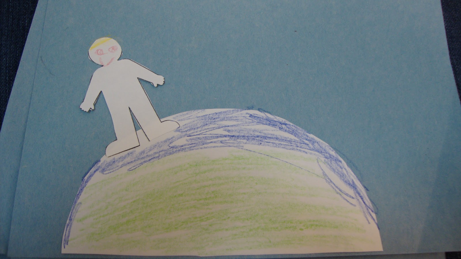
Finally, we zoomed ALL the way out and discussed our planet, Earth. We pulled up Earth on Google Maps and watched how we could zoom in or out to see from our very own houses all the way out to Earth and vice versa. The kids wanted to look up all kinds of different places. we discussed why the Earth looks like it does from space and learned why parts of it are blue, green , or white. The children had to make their very own Earth and show themselves on it.
 |


We'll dig much deeper into maps in First Grade, but this was a great introduction to maps and to help us know where we live. The children enjoyed making their maps each day and I was really impressed with their great work!
No comments:
Post a Comment